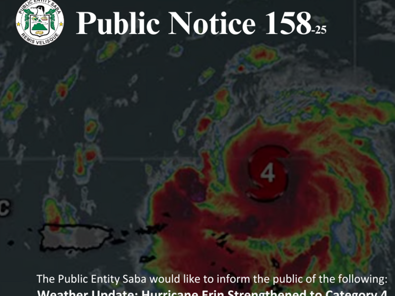
Hurricane Erin is now forecast to pass north-northeast of Saba as a Category 4 hurricane on the afternoon of Saturday, August 16. The closest point of approach is expected to be approximately 190 miles (305 kilometers) north-northeast of the island around 2:00 p.m. AST.
While Erin is not expected to make direct landfall or have direct impact on Saba, current projections indicate a 20 to 25 percent chance of tropical storm–force winds affecting the island. The probability of hurricane-force winds remains extremely low, between 1 and 3 percent.
Residents can expect sustained winds of 25 to 30 miles per hour (around 45 kilometers per hour), with gusts reaching up to 40 miles per hour (60 kilometers per hour). Sea conditions are forecast to become moderate to rough, with northeasterly swells expected to impact coastal areas.
Heavy rainfall is expected to have the most significant local impact. More than 4 inches of rain has already fallen, with an additional 1-2 inches being likely in the next few hours, totalling 6 inches (150 millimeters). This is possibly accompanied by thunder. These conditions increase the risk of flash flooding, urban flooding, and landslides or mudslides in vulnerable areas.
The public is strongly urged to exercise extreme caution if using the road during this period. Wet and slippery conditions, combined with poor visibility and the risk of debris or small slides, may make driving hazardous. Residents are advised to avoid non-essential travel and to delay any movement until conditions improve.
As a precaution, all travel to and from Saba remains suspended for Saturday. All scheduled Winair flights have been cancelled, and charter services are also expected to be suspended. The Makana Ferry Service has confirmed the cancellation of all routes for both Saturday and Sunday.
Residents are encouraged to monitor official updates closely, secure their homes and surroundings, and check on vulnerable neighbors, especially the elderly. Weather conditions are expected to deteriorate during the day on Saturday, with gradual improvement anticipated on Sunday.
Authorities continue to monitor Hurricane Erin closely and will provide further updates as the situation evolves. For official information and guidance on hurricane preparedness, please visit: www.sabagov.nl/.../disaste.../hurricane-preparedness.
Weather Update: Hurricane Erin Strengthened to Category 4